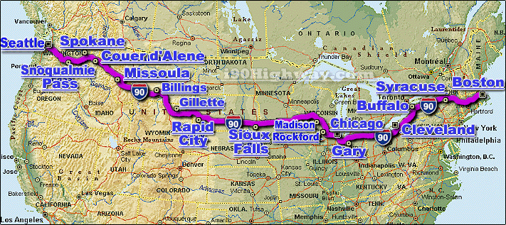
The I-90 Interstate 90 Highway is
a major
automotive & trucking transportation
corridor and interstate highway that travels generally in a east-west direction
across the United States.The i-90 travels through a total of 13 different US
states, including; Idaho,
Illinois, Indiana,
Massachusetts,
Minnesota, Montana,
Ohio, New York,
Pennsylvania,
South Dakota,
Washington, Wisconsin,
& Wyoming.
The i-90 connects a number of larger cities located along or near it's route,
including;
Billings,
Boston,
Buffalo,
Chicago,
Cleveland,
Coeur d'Alene,
Erie,
Gary,
Madison,
Rapid City,
Rockford,
Seattle,
Sioux Falls,
Spokane,
and Syracuse, just to name a
few.
From the east, the i-90 travels from the
Boston
area, and from the west, the i-90 travels from the
Seattle
area.
The entire length of the I-90 is approx. 3,020 miles long, and requires a
continuous driving time of approx. 50 hrs. and 20 minutes to complete.